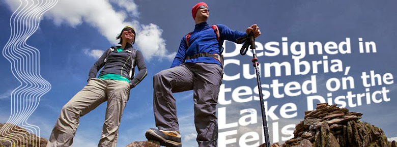
EDZ supporting Ukantrail SBU35 Race
EDZ are pleased to announce that we will be supporting the UKanTrail SBU35 event. This is a 36 mile ultra trail race which runs along St Begas way from near Bassenthwaite in Keswick out to the coast at St Bees.
Entries are still available and full details can be found at the UKanTrail Website
Ukantrail say the following about the race:
Overview
The SBU35 is an, 'as tough as you want it', largely offroad ultra trail race, following a point to point route, from the heart of the Lake District to the West Coast. Based on the long distance route the St Begas Way, runners follow the route of a legendary Irish princess, travelling between two chapels, that both bear her name.
We originally designed this event with new ultra runners in mind. Feedback from last year's event showed that we'd got it right, with new runners loving the advice and friendly support they received. Experienced ultra runners rated the event as well and after a surprise entrant last year, some impressive winning finish times were set, proving this event to be a good choice for experienced ultra runners who want a fast course
The Start is in the heart of the Lake district on the shores of Bass Lake near Keswick, and the Finish and race HQ is in the west coast village of St Bees, the start of Wainwright's coast to coast walk.
Between these two points, lay 36 miles of some of the most beautiful country, the Lake District has to offer.
Route Description. From the wooded shores of Bassenthwaite lake, the route climbs on forest tracks before descending to the shores of Derwentwater. Through low level woods, the route hugs the lakeshore before heading south, through the 'Jaws' of Borrowdale. Ahead, a momentous climb begins and joins the old wagon road trail, passing through Honister Slate Mine and finishing with one of the steepest sections of track you'll have ever seen. The character of the event changes then, as runners enter the remotest section of the route, heading out over open fell and then descending, stunningly into the uppermost end of the secluded Ennerdale valley. There are no roads here and the only vehicle you're likely to see in this truly remote valley, is the Black Sail Youth Hostel warden's Landrover. After tracking the full length of this isolated and beautiful place, the route climbs steeply once more, giving runners their first view of the sea. After the final challenge of Dent Fell and a punishing descent, the route drops into the final valley, with the village of St Bees at its head.
Here, a warm, warm welcome, awaits each runner.
This route is a journey, in every sense...
General Event Details. We've set very generous cut-off times at the checkpoints, whilst we've got two, stunningly fast course records, that'll challenge even top-flight runners. Fastest Male 5:12:31, Fastest Woman 5:49:56, Last Finisher 11:23:52, Average Finisher 08:20
Navigation is required, but simple! The course is unmarked, but all runners receive a fully waterproof, tearproof, detailed road book, with both OS based maps and clear text. In-experienced navigators who took part last year, loved it! There will also be a full .gpx file of the route, to download.
All of our checkpoints are based in permanent buildings, with toilets and will be continuously staffed by marshals, qualified First Aiders and radio operators.
All runners will receive:
- A comprehensive road book, complete with mapping
- Access to a GPS file of the route
- Free coach transport to the start
- Trail snacks at each checkpoint
- Qualified medical staff at each checkpoint
- Finish line food
- Free pint of beer from our local, Ennerdale brewery. (This was a tremendous hit last year and many a pint was supped after the event)
- A chance to win one of, as many spot prizes that we can get our hands on again!
Restricted to finishers only (We feel that you value most, those things that you work hardest to achieve), each finisher will receive our traditional, Honister Slate finishers medal and a commemorative, race branded, leisure tshirt.(In research and feedback from last year's entrants, people said that they had enough technical T's to last a lifetime, so this year, we're offering something a little different)
Safety. There will be a reasonable, minimum kit list specified, reflecting the terrain, distance and the 'on the day' conditions.
We've listened to feedback from runners last year and there will be some reduction in the minimum kit. We have also decided to repeat the practise last year, of 'on the day revision' where an assessment of the weather conditions 'on the day', allowed us to reduce the mandatory kit for experienced runners and this practise will be followed again this year. However all runners must arrive on the day, prepared to race with all of the minimum kit, should weather conditions dictate it.
Our aim this year is the same as last, to get each and every one of you over the entire route, safely, with the minimum of fuss and the maximum amount of satisfaction.
Logistics. Race HQ/registration is located at the Finish in the West Coastal village of St Bees. Coach transport from there to the start, will be provided. Race start 08:00. Course cut off: 12 hrs. Checkpoints/feed stations at 10,20 and 30 miles approx. Checkpoint cutoff times will be pro-rata'd by distance and will be enforced. The course is approx.36 miles long, has 4000ft of ascent and 4500ft of descent. The route will not be signed, but an excellent, detailed, CLEAR, road book will be provided. Navigation skill level required - Low.
Note: This event is held under UK Athletics rules. Entrants must be 21yrs or over on raceday. Minimum kit will be required. GPS navigation file and Road Book will be included
Trail Running Association Permit : Applied for.

No comments:
Post a Comment